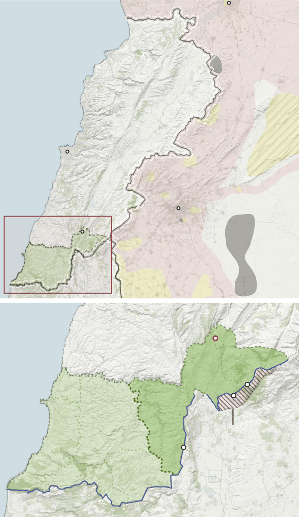
Why are Spanish troops scattered all over the Mediterranean?
Old and new conflicts have made the shores of the Mediterranean one of the most insecure places on the planet. The refugee crisis, which has plagued Southern Europe for decades, has been aggravated by instability and chaos in Libya and Syria. Branches of Islamist terrorism in North Africa and the threat of the Islamic State represent a danger to peace in the region, especially the Middle East, where many conflicts of the last century are still open.
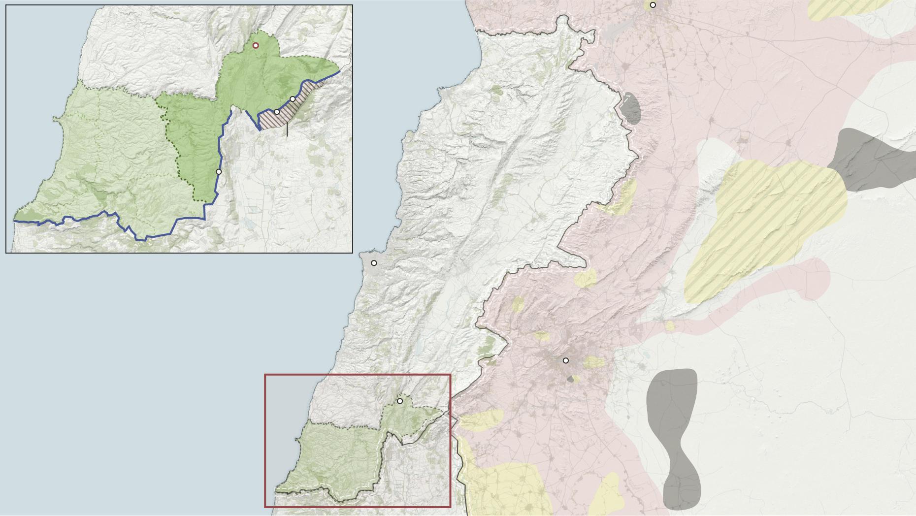
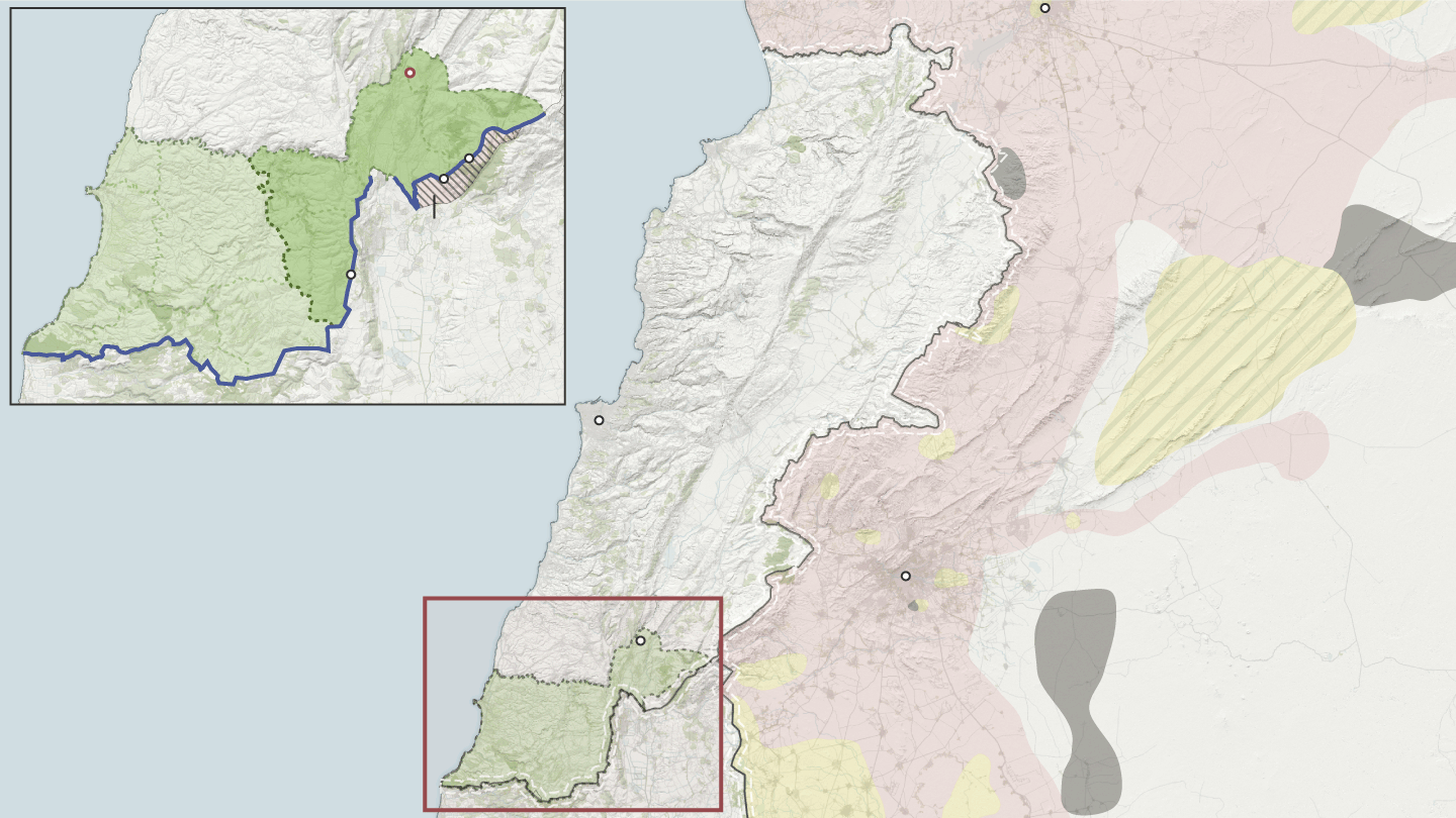
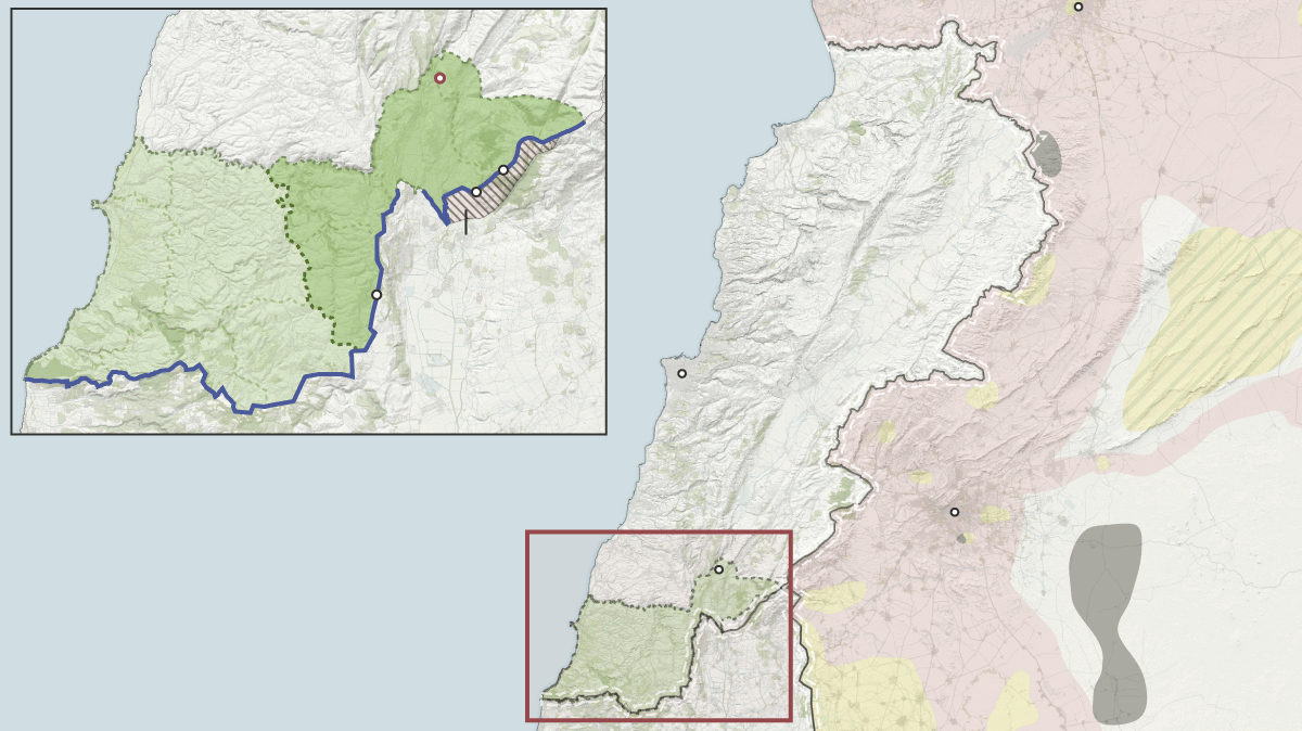
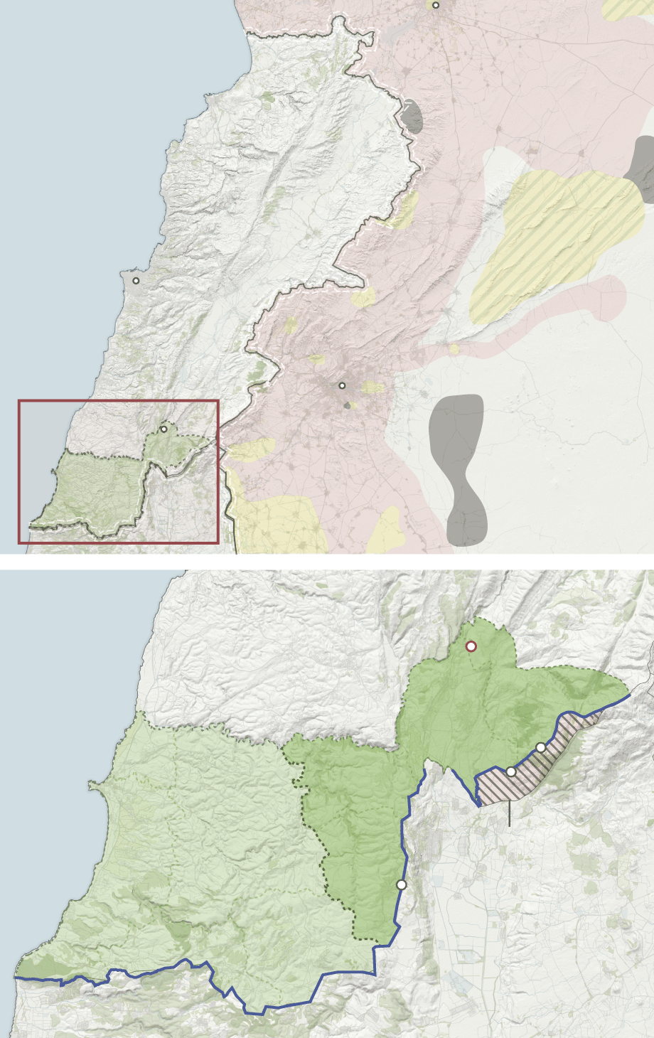
My colleague Giulio M. Piantadosi had the chance to visit three of the places where Spanish forces are present. The Naval Air Station Sigonella in Sicily, UNIFIL Deployment at the blue line in Lebanon and the Incirlik Air Base in Turkey.
Homs
Base Miguel
de Cervantes
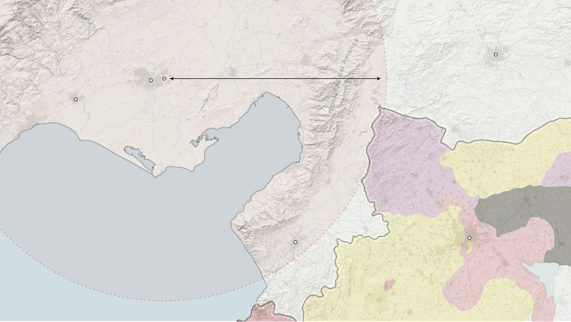
líbano
Gobierno
Bashar al-Asad
Sector
este
Río Litani
Mando
español
4-34
Al Ghajar
UNIFIL
Territorio ocupado
por Israel en 2006
Sector
oeste
ISIS
8-33
israel
Control Mixto
blue line
líbano
Beirut
Damasco
mar mediterráneo
siria
ISIS
Gobierno
Bashar al-Asad
UNIFIL
israel
Fuerzas de
la oposición
Homs
Base Miguel
de Cervantes
líbano
Gobierno
Bashar al-Asad
Sector
este
Río Litani
Mando
español
4-34
Al Ghajar
UNIFIL
Territorio ocupado
por Israel en 2006
Sector
oeste
ISIS
8-33
israel
Control Mixto
líbano
blue line
Beirut
Damasco
mar mediterráneo
siria
ISIS
Gobierno
Bashar al-Asad
UNIFIL
israel
Fuerzas de
la oposición
Homs
Base Miguel
de Cervantes
líbano
Gobierno
Bashar al-Asad
Sector
este
Río Litani
Mando
español
4-34
Al Ghajar
UNIFIL
Territorio ocupado
por Israel en 2006
líbano
Sector
oeste
8-33
Control Mixto
israel
Beirut
blue line
Damasco
mar mediterráneo
ISIS
siria
Gobierno
Bashar al-Asad
UNIFIL
Fuerzas de
la oposición
israel
Homs
Gobierno
Bashar al-Asad
mar mediterráneo
líbano
Control Mixto
Beirut
siria
Damasco
ISIS
Gobierno
Bashar al-Asad
UNIFIL
Fuerzas de
la oposición
israel
Base Miguel
de Cervantes
líbano
Sector
este
Río Litani
Mando
español
4-34
Al Ghajar
UNIFIL
Territorio ocupado
por Israel en 2006
Sector
oeste
8-33
israel
blue line
Homs
Gobierno
Bashar al-Asad
mar mediterráneo
líbano
Control
Mixto
siria
Beirut
Damasco
ISIS
UNIFIL
Fuerzas de
la oposición
israel
Base Miguel
de Cervantes
líbano
Sector
este
Río Litani
Mando
español
4-34
Al Ghajar
UNIFIL
Sector
oeste
Territorio ocupado
por Israel en 2006
8-33
israel
blue line
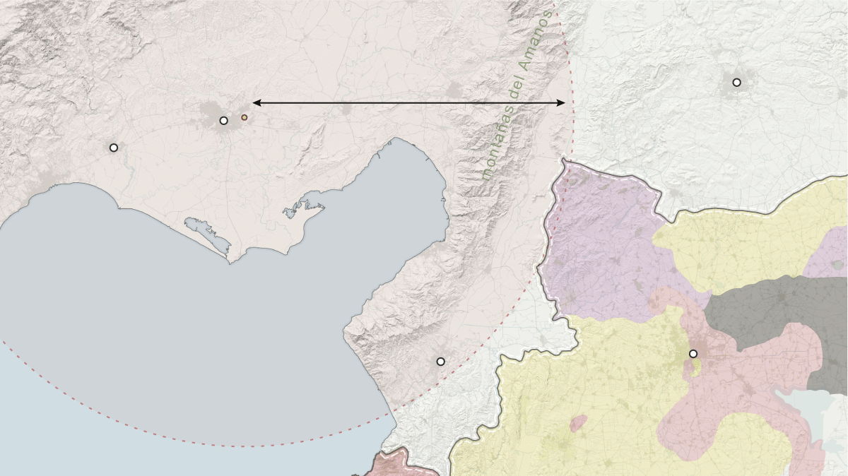
It was a great opportunity to work hard on the maps, to improve and use new techniques and tools that make that maps a little bit better than others I made before. So I made a basemap in QGIS using OSM shapefiles as landuse or roads playing with soft colors and rule-based styles. In two of the three maps I used the The Earth’s Relief DEM layer, make by ClusterGIS. Then I drew all the labels, arrows, polygons and other vectorial elements in Adobe Illustrator.
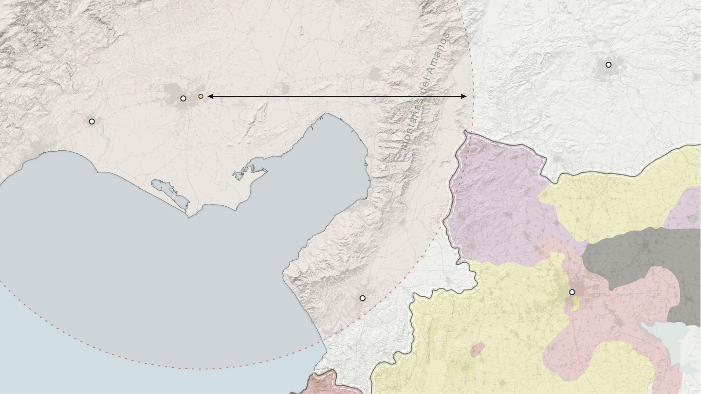
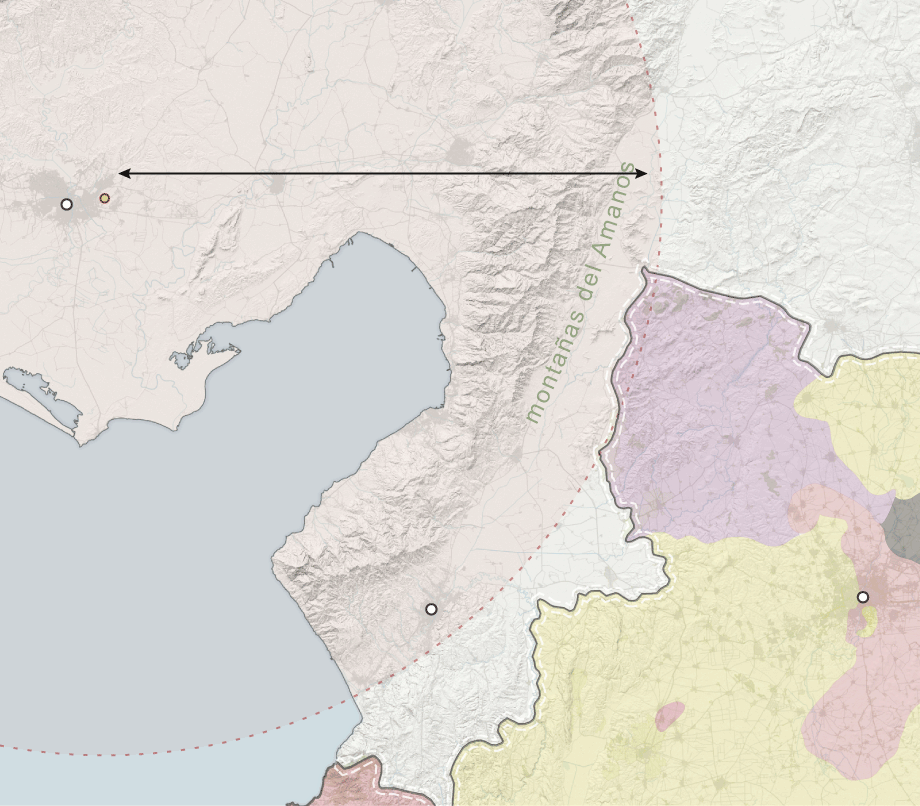
turquía
Gaziantep
Base aérea de
Radio de alcance de las
baterías antiaéreas Patriot
Incirlik
Adana
120km
Tarsus
Golfo de
Alejandreta
Milicias
kurdas
siria
Estado Islámico
mar mediterráneo
Antioquía
Alepo
Gobierno
Bashar al-Asad
Fuerzas de
la oposición
turquía
Gaziantep
Base aérea de
Radio de alcance de las
baterías antiaéreas Patriot
Incirlik
Adana
120km
Tarsus
Golfo de
Alejandreta
Milicias
kurdas
siria
Estado Islámico
mar mediterráneo
Antioquía
Alepo
Gobierno
Bashar al-Asad
Fuerzas de
la oposición
turquía
Gaziantep
Radio de alcance de las
baterías antiaéreas Patriot
120km
Base aérea de
Adana
Tarsus
Incirlik
Golfo de
Alejandreta
Milicias
kurdas
siria
Estado Islámico
mar mediterráneo
Antioquía
Alepo
Gobierno
Bashar al-Asad
Fuerzas de
la oposición
turquía
Radio de alcance de las
baterías antiaéreas Patriot
Adana
120km
Base aérea de
Incirlik
Golfo de
Alejandreta
Milicias
kurdas
siria
ISIS
mar
mediterráneo
Alepo
Antioquía
Fuerzas de
la oposición
Gobierno
Bashar al-Asad
norte
turquía
Adana
Base aérea
mar
mediterráneo
de Incirlik
Golfo de
Alejandreta
120km
Alcance de las baterías
Antioquía
antiaéreas Patriot
milicias
kurdas
fuerzas de
la oposición
Alepo
turquía
siria
gobierno
Bashar al-Asad
ISIS
Finally I used the ai2html plugin for Adobe Illustrator to publish on the web. I created five designs for each map, fifteen Artboards in total. ai2html uses CSS’s display block/in-line to show correct artboards depending on screen size. If we don’t use a script or a lazy load the reader will have to download the images for all the screen sizes. To fix that I created an easy script which downloads only one image for each resolution.