Why Did the Tenerife Wildfire Spread So Rapidly?
Context
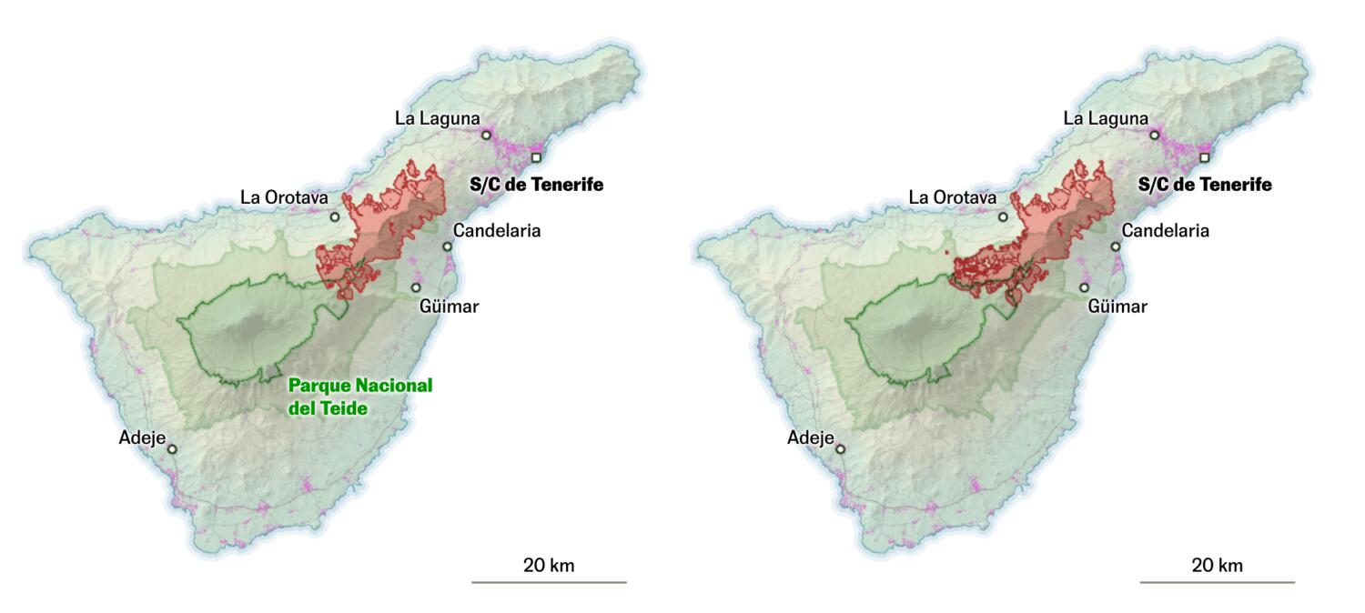
This story analyzes the Tenerife wildfire through terrain, vegetation, and wind context to explain why the fire accelerated so quickly. I translated topographic and land-cover information into layered cartographic views that made fire behavior and propagation factors easier to interpret.
My role
- Cartography
- Data analysis
I led the cartographic implementation under tight deadline constraints, focusing on map clarity and relief design to explain fire behavior in highly rugged terrain.
Data and methodology
Although produced in only a few hours, the piece combined Copernicus fire snapshots, land-cover context, and settlement exposure into a compact explanatory map sequence.
To represent Tenerife's steep topography, I built a shaded-relief workflow in Blender based on Daniel Huffman's approach, using terrain-prepared inputs from QGIS.
Key decisions
- I prioritized strong shaded relief as the structural base of the maps, because terrain was central to understanding acceleration and fire spread.
- We kept thematic layers intentionally minimal to avoid clutter, while preserving key information on burn evolution and populated areas at risk.
- Color palette and contrast were tuned for rapid interpretation, so readers could understand progression and exposure at a glance.
Result
The final article delivered a concise but visually robust explanation of the wildfire dynamics and territorial vulnerability, despite very limited production time.
Impact and learnings
- The piece became a useful internal benchmark for high-quality emergency cartography under newsroom pressure.
- It also consolidated my Blender + QGIS terrain workflow, which I later streamlined further with a one-step QGIS model for heightmap preparation.