Melilla border tragedy: step by step
Context
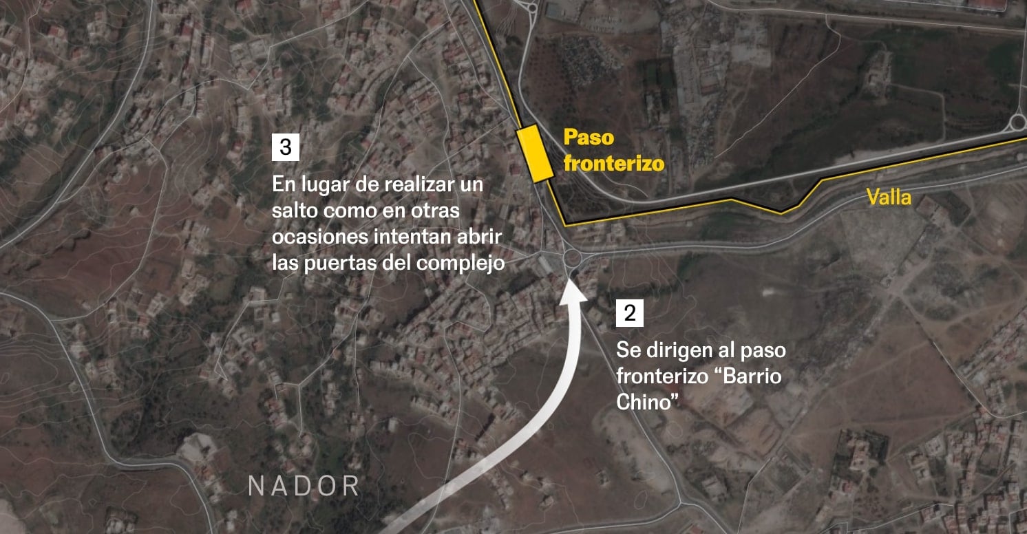
A forensic reconstruction of the Melilla border tragedy built from geolocated videos, witness accounts, and synchronized timelines. The goal was to establish a clear sequence of events and spatial positions, turning fragmented visual evidence into a coherent public record.
My role
- Visual forensics
- Cartography
I led the spatial reconstruction workflow, turning fragmented visual evidence into a coherent geographic narrative that located where and when key moments occurred.
Data and methodology
Because baseline geographic information was scarce at the time (limited satellite quality, no Street View, and little structural documentation of the site), the reconstruction relied heavily on systematic video analysis.
I extracted frames with ffmpeg and reviewed footage in detail to build a spatial model of the area, then aligned available clips and testimonies into a synchronized timeline with location markers.
Key decisions
- We treated the piece as a forensic reporting exercise, prioritizing sequence validation and positional consistency over visual complexity.
- The narrative was built around geolocated video points so readers could follow the reconstruction step by step from evidence to interpretation.
- Given source limitations, we used a schematic but rigorous spatial representation to avoid false precision while preserving accountability value.
Result
The final story provided one of the clearest public reconstructions of what happened at the Melilla fence that day, converting scattered footage into a readable investigative timeline.
Impact and learnings
- The project reached conclusions that were not publicly established at the time and reinforced the newsroom value of visual-forensic methods.
- It also strengthened a core investigative skill: extracting high-value information from minor visual details when primary sources are incomplete.