The death of the last glaciers in Spain
Context
This long-form story documents the retreat of Spain's last glaciers through field reporting and scientific evidence from the Pyrenees. I worked on maps and explanatory graphics that linked local ice loss to broader climate dynamics while keeping the narrative grounded in observed data.
My role
- Data analysis
- Cartography
- Frontend development
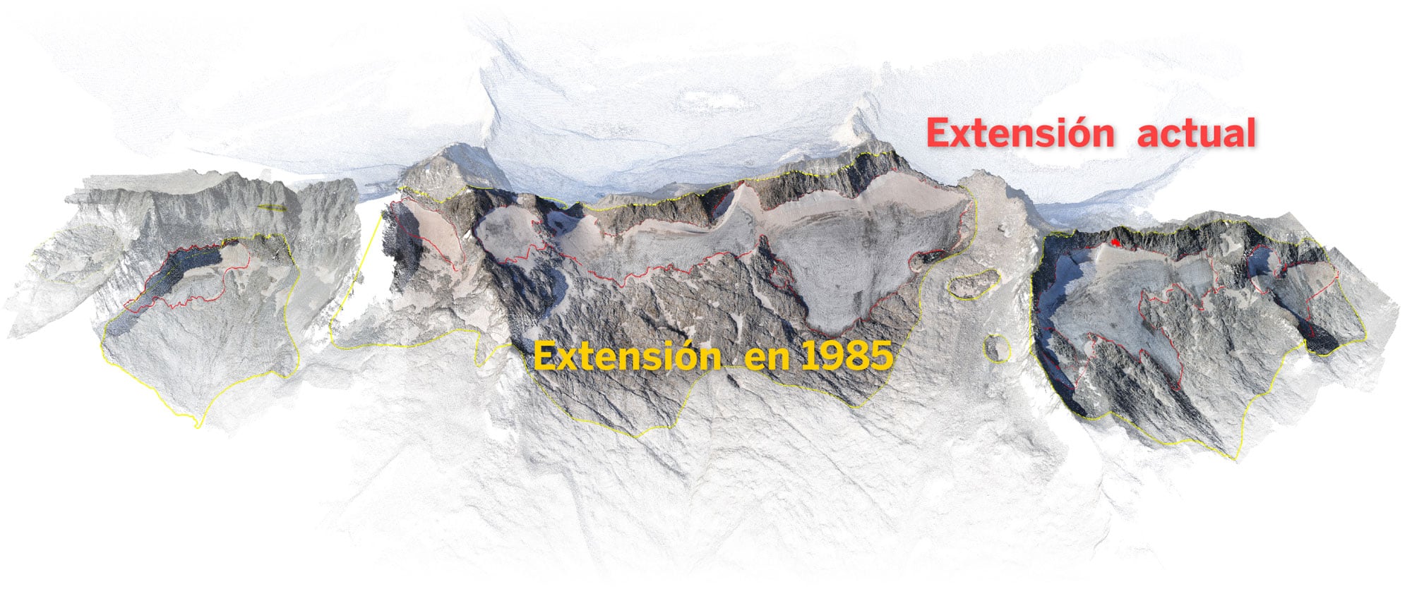
I developed the cartographic and visual layer, connecting local glacier retreat in the Aneto area with broader climate dynamics through maps, 3D views, and explanatory graphics.
I co-designed the opening visual sequence and worked on processing and adapting scientific glacier-extent data for publication.
Data and methodology
The project was built in close collaboration with the science desk and through direct meetings with the research team that measured glacier extent over multiple years.
A major technical step was learning CloudCompare to process and export LiDAR-derived point-cloud outputs provided by scientists.
For territorial context, I produced a shaded-relief basemap in Blender suited to steep Pyrenean topography and integrated historical glacier extents from satellite-derived shapefiles.
Key decisions
- We opened with a scrolly-video sequence over a 3D glacier model to make temporal retreat visible from the first interaction.
- I attempted to smooth historical glacier polygons to reduce pixel-like edges from satellite-derived geometry and improve perceived naturalness.
- The visual narrative prioritized explanatory continuity between scientific evidence and reader comprehension, even when source geometry quality imposed clear aesthetic constraints.
Result
The final piece clearly documented how the southernmost glaciers in Europe are shrinking toward disappearance, combining scientific evidence with accessible visual storytelling.
Impact and learnings
- The project was a major technical learning milestone, especially in LiDAR/point-cloud handling and high-mountain 3D cartography workflows.
- It also provided a useful editorial lesson on balancing data fidelity and visual polish when source formats and historical records have uneven quality.