La Palma volcano: tunnels, caves, and devastation
Context
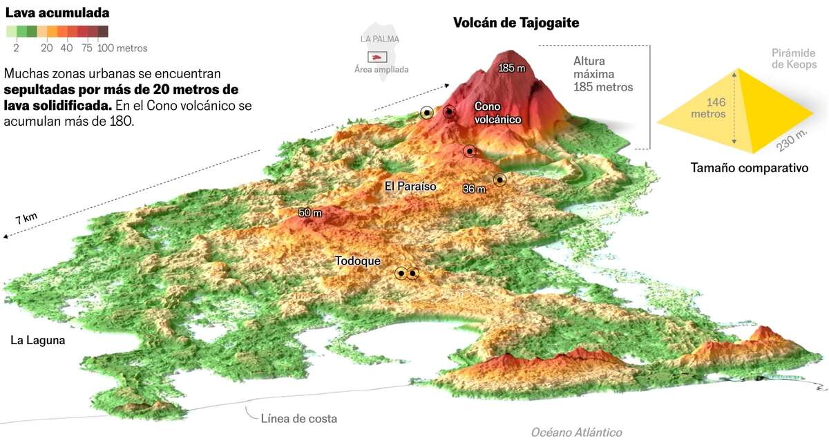
This piece follows scientific exploration of the volcanic tube system formed after the La Palma eruption, where extreme internal temperatures still limit access. I used cartographic context and explanatory graphics to connect underground structures with the surface landscape transformed by lava flows.
My role
- Cartography
- Data analysis
I led the geospatial analysis and visual implementation, producing both the volumetric-difference layer and the cartographic narrative used to explain the eruption's physical footprint.
Data and methodology
The core analysis compared pre- and post-eruption digital terrain models to derive an elevation-difference surface representing newly deposited volcanic material.
I iterated the workflow against published scientific references, including the related Nature dataset paper, to validate assumptions and approach quality before publication.
Key decisions
- I chose an oblique 3D rendering in Blender to make the volume and shape of deposited material immediately understandable.
- The piece combined this 3D perspective with an annotated map layer to connect scientific measurement with place-based interpretation.
- Visual simplification focused on contextual labels and key geomorphological cues rather than dense technical symbology.
Result
The final story provided a clear visual estimate of the eruption's surface impact and helped readers understand the scale of volcanic deposition beyond headline figures.
Impact and learnings
- The article performed well in readership and became a strong applied example of terrain-difference analysis in explanatory journalism.
- It also advanced my Blender + geodata workflow, especially for turning derived raster products into high-legibility oblique views.