Hamas Resurges in Gaza Areas That Israel Considered Dismantled
Context
This project documents how armed activity reappeared in parts of Gaza that had been publicly presented as dismantled. The piece combines event mapping and conflict chronology to connect military developments with their territorial footprint and civilian impact.
My role
- Cartography
- Frontend development
- Data analysis
I co-developed the narrative with Javier Galan and implemented the full visual scrollytelling layer, combining Svelte and Mapbox to make a complex conflict sequence readable.
Data and methodology
The piece was built as a coordinated newsroom workflow, iterating the editorial angle and geographic focus while integrating conflict events into a time-based map narrative.
We structured the story as a mixed scroller with cartography, contextual text, and embedded videos so readers could follow both territorial movement and on-the-ground consequences.
Key decisions
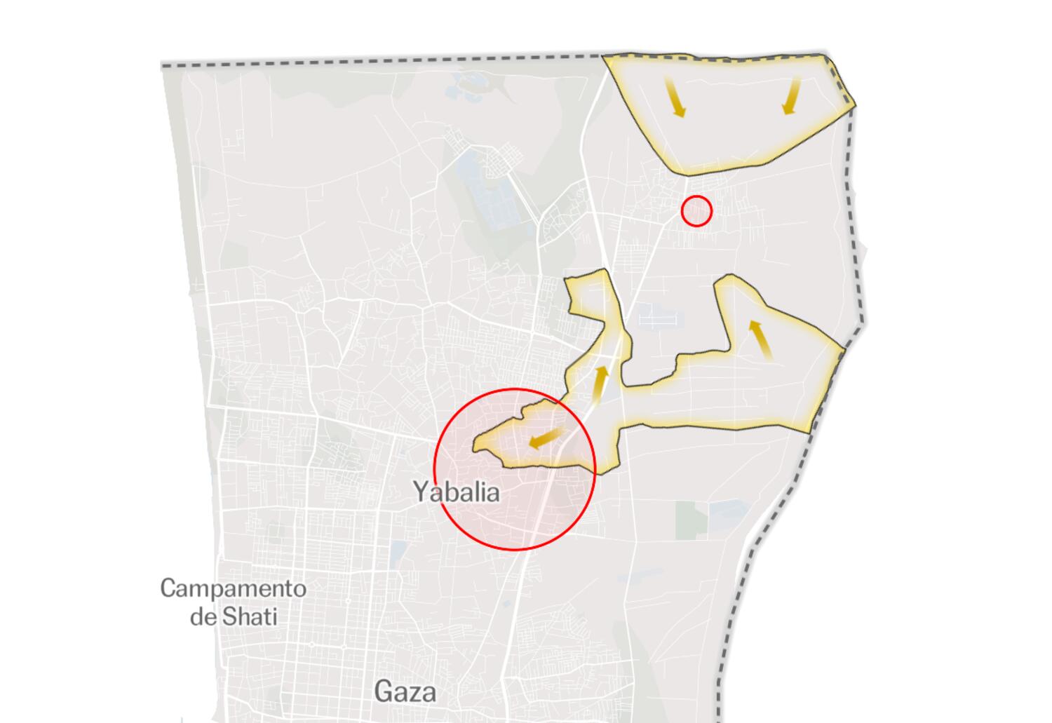
- We used a scroll-driven Mapbox structure to guide the reader through operational phases instead of presenting static front lines only.
- Because Mapbox does not offer a clean native way to render certain arrow-style tactical annotations, I produced georeferenced raster satellite layers with custom overlays (arrows, geometric operation zones) to enrich narrative precision.
- We intentionally combined map states with video inserts to add context and reduce abstraction in a highly mediated conflict environment.
Result
The final article delivered a layered territorial reconstruction that connected operational claims with observed activity and evolving control on the ground.
Impact and learnings
- The piece had strong public reach and reinforced the newsroom value of map-led conflict explainers.
- From a product perspective, it helped consolidate a reusable technique based on annotated georeferenced satellite rasters integrated into Mapbox scrollytelling.