1992 Olympics in Barcelona: the city that changed forever
Context
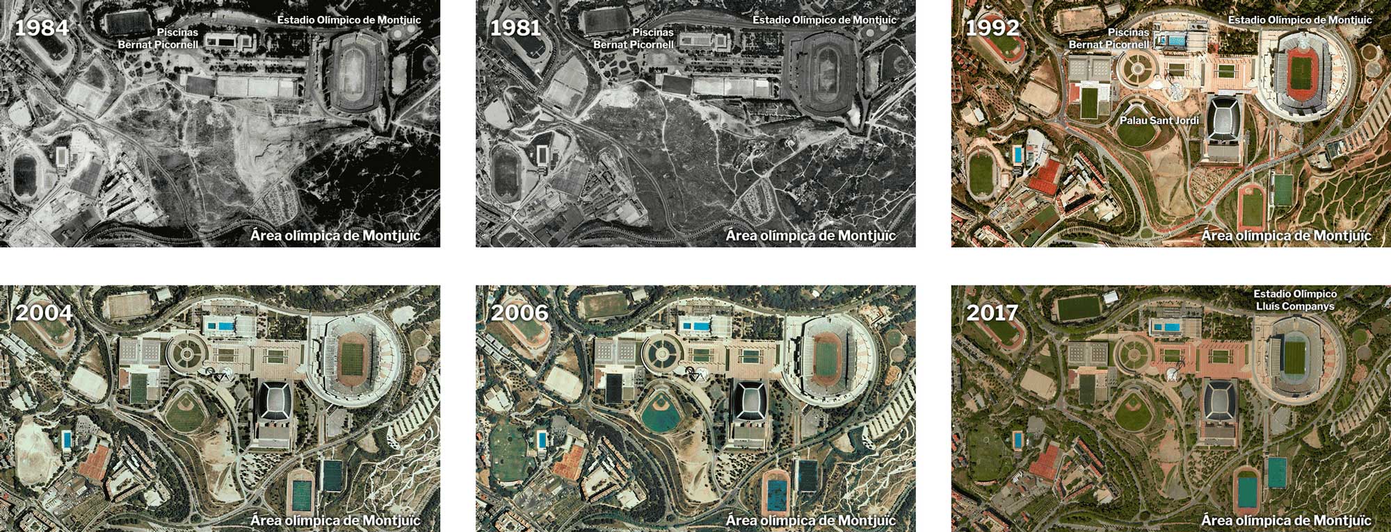
Published for the 25th anniversary of Barcelona 1992 at El Independiente, this piece compares aerial and satellite imagery to show how the Olympics permanently reshaped the city.
My role
- Data analysis
- Cartography
- Frontend development
I handled the geospatial comparison workflow, aligning imagery from three different coordinate reference systems so the before-and-after scenes were directly comparable.
I worked with QGIS for raster processing and used Photoshop for labeling and minor placement corrections.
Data and methodology
The analysis centered on emblematic areas such as Parc del Mar and the Montjuic Olympic Stadium zone to make structural urban change visible.
Each frame was prepared as a visual pair that connected historical context with concrete land-use and infrastructure transformation.
Key decisions
- Prioritized projection consistency first, because any misalignment would undermine the historical comparison.
- Focused on a small set of representative locations instead of citywide saturation to keep the narrative legible.
- Used lightweight labeling and annotation to explain transformation without obscuring the source imagery.
Result
The final feature provided a clear visual account of how Olympic investment changed Barcelona's morphology and waterfront.
Impact and learnings
- It connected anniversary coverage with measurable spatial evidence, helping readers understand long-term urban policy effects.