Apartment towers: targets of the Israeli invasion in Gaza City
Context
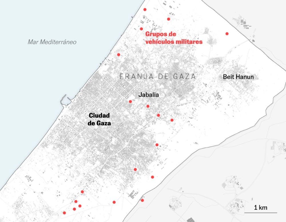
A map-based explainer about Israeli operations in Gaza City, focused on recurrent strikes against apartment towers and their spatial concentration across the urban fabric.
My role
- Cartography
I led the cartographic work, structuring the geographic narrative and visual hierarchy to make strike patterns and neighborhood-level context readable in a single map-driven story.
Data and methodology
The analysis combined Planet Labs satellite imagery, strike-location mapping, and neighborhood-level reference layers to identify where and how frequently apartment towers were hit.
A key comparison focused on scenes where refugee tent encampments are visible, documenting renewed displacement in Gaza City after 23 months of conflict.
We structured the piece as a concise visual explainer, prioritizing spatial clarity, fast reading, and consistency between annotations and mapped evidence.
Key decisions
- We prioritized a map-first structure so readers could quickly locate the main strike clusters across Gaza City.
- We calibrated zoom levels carefully to make refugee tent encampments perceptible without losing city-scale context, a particularly difficult balance on mobile screens.
- Annotations were kept short and positional, since labeling dense satellite scenes without obscuring key evidence required strict visual restraint.
- Visual hierarchy was simplified for mobile reading so tower locations, strike patterns, and displacement signals remained legible on small screens.
Result
The final piece delivers a clear geographic reconstruction of how apartment towers in Gaza City were targeted, combining strike chronology with high-resolution satellite comparisons to make urban impact and displacement patterns visible.
Impact and learnings
- The project reinforced a repeatable workflow for conflict explainers based on high-resolution satellite reporting, precise cartographic framing, and fast newsroom production.
- It also confirmed the editorial value of pairing strike mapping with displacement evidence, especially under mobile-first design constraints.